I've heard of geocaching before and thought it sounded cool, but not something I had time to do. Prior to the days of iPhone ownership, a GPS wasn't something I had handy all the time. Well, times have changed, my friends, and GPS devices are pretty much everywhere...as are the caches.
For those unfamiliar, geocaching is like a go-at-your-own-pace treasure hunt. There's an entire community of geocachers out there who hide (and seek) multitudes of goodies. Some cachers are pretty hard-core trying their best to be the FTF (first-to-find). But some caches have been around for years and scanning through the log books can be an awe-striking moment. Micros are pretty small - usually only consisting of a log to keep record of the finders. The most common, traditional caches, are ammo boxes, just large enough to hold a log book, and a few relatively inexpensive trinkets. The thrill is in the adventure of finding the hidden caches, learning about the community around you, and tracking items (like geo-coins that are moved from cache to cache) around the world.
For more info on geocaching or what caches are near you, check out www.geocaching.com and get started!
My family has been bitten by the geocaching bug. My older daughters (ages 8 and 6) are enthralled with the adventure of looking for a treasure, a welcomed motivator to get them outdoors. We ventured out for the afternoon and made four finds, each one with their own personality. We had some pretty cool eureka moments, all shared together, for no out-of-pocket expense. Compared to a family night at the movies, with tickets and snacks upward of $60 and the lot of us staring off at a movie screen, I'd say geocaching is a win-win for the family and the pocketbook!
As we dive into this family adventure we are learning some of the geocaching etiquette that keeps the game moving along. Obvious things like paying attention to your surroundings, not drawing attention to the cache location (beware of "muggles"), and programs like "Cache in, Trash out" are important mindsets that allow geocaching to work. A nice listing of geocaching pointers are provided HERE, and definitely worth a good read before heading out on your adventures.
My girls have come up with their own geocaching team name - the SillyBandits. They want to leave silly bandz (the many colored, many shaped, over-priced rubber bands) at all the caches they visit. Now when we head out of the house, and across town, we're checking what kind of detours we may make along the way. With an upcoming family vacation, involving driving through multiple states, we are excited see what kind of swag we find, places we visit, and communities we connect with.
Do you geocache? Leave a comment and tell me about your best cache experience or cool swag!
Saturday, June 26, 2010

Sunday, June 6, 2010
Down to the Core
I've had the rare priviledge in the course of my project work to be able to truly ground-truth interpretations from seismic data through comparisons with core samples. For onshore projects that may not seem like so much of a priviledge as the norm, but in deepwater environments, the combination of data is much less common, particularly in the early exploration stages of which I'm involved.
I have my interpretation of stratigraphic intervals and the kinds of processes that may be at work based on the regional setting, observed site-specific structures, and by characteristics revealed through various seismic attributes. Then I have core data to add to that interpretation, refining the model of what we think we're seeing. The core data includes various geotechnical properties measured through standard lab tests, such as shear strength, water content, atterberg limits, etc. These lab tests, standard and advanced, are destructive to the sample. For my project we also have a radiocarbon and paleontological dating program planned, to try and understand the depositional rates and timing of events. Selecting the sample locations, considering both time and space (where in the core and from which core), is a critical step towards putting the geologic story back together and involves close inspection of the interpreted seismic data, correlation of geotechnical properties between the physical sample and the geophysical record, and understanding what an age at a particular portion of the core can and can't tell you. Digging out samples for age analysis is obviously destructive to the core also. If you have plans to undergo geotechnical testing, you have to make sure you aren't using material you also want to get an age from. It definitely takes some thinking and planning out.
There are some things that can be done to analyze a core without destroying the sample. A multi-sensor core logger, or MSCL for short, is a tool that allows for geophysical measurements of an unsplit, cylindrical core. Working in the marine environment, we've used MSCL for sub-samples of box cores, as well as gravity cores, piston cores, and jumbo piston cores. Compressional wave (P-wave) transducers allow for velocity measurements of the sediments in the core. Gamma ray attenuation is measured through the core and used to derive sediment density. The labs I've worked with can provide various levels of detail for logging, such as 4 cm samples or higher resolution 2 cm sampling. If the core is later split, or material was sampled from the core ends during acquisition, the densities may be calibrated with the lab measurements taken directly. Velocities and densities also play important roles in how the seismic data behaves, so with the MSCL data, the measured geotechnical properties, and the seismic section you can start to make some correlations. Accurate and precise calibration of the MSCL for your samples and close QA/QC of the data are key to getting the most useful data.
Ultimately, if you want to understand the small-scale features, you have split open the core and take a look at the sediment types and preserved structures. This, too, is a destructive process. Once the core is split, you can't put it back together again.
One of the best things you can do with your split core is to photograph it. As with all geologic-intended photographs you will need something in the photograph to reference for scale. Some people place a measuring tape or ruler along the core edge, others mark directly on the core liner in regularly spaced intervals. In the process of describing your core, you are likely to scrape, smudge, cut, poke, and sub-sample the sediments. You might even taste the sample (Yes, a lot of geologists will taste the dirt). In addition, an open core will dessicate and oxidize much quicker than an un-opened core (even in controlled storage environments), which means color, water content, and other geotechnical characteristics can change. While a core photograph cannot capture the geotechnical properties, it can preserve color and structural relationships to which you can refer to long after your sample has been picked through or discarded. A photograph is an important piece of your compiled data set that may prove useful even beyond its original intended use for your project.
It has been my experience that most labs and researchers rush through the steps of capturing those photos. Some are done with basic point-and-shoot cameras, with little attention to lighting, resolution, or focus. Even photos done meticulously with a high-resolution camera suffer from amateur photographers in control of the picture-taking. My recent project data included high-resolution core photographs taken every 10 cm down the length of the core. A lab technician cropped each image and stitched them together to re-create each core section. The files were 100+MB bitmap images exported out of Adobe Photoshop. The resolution on the images was undeniably good, but most sections were coarsely scraped creating ridges and shadows on the split section, the high water content and lighting caused problematic reflections, and poor light distribution made many of the sections dark and the variable colors difficult to distinguish.
When preparing to photograph your core, there are several things to consider. First, the cores are best viewed in natural light. Flourescent lights tend to add hints of blues to the photo. Incandescent lights tend to add hints of yellow to the photo. Neither are desireable if you want to look at the natural colors. Adjusting the white balance compensates for your light source and allows you to mimic natural sunlight when done correctly. Just a note: Color is not always the best geologic tool in the box, as it can be decieving at times. Be careful with what assumptions you make based solely on color.
Second, you want to look at a fresh surface, which suggests you may need to scrape the sediments exposed in your split core. Scraping the core surface is a delicate procedure. You want to scrape across the core, not down the core. Scraping down the core could contaminate your sample, mixing younger and older sediments as you drag the spatula down the core. Scraping across minimizes that potential, assuming you clean the spatula between each stroke. Many people who scrape a core, particularly if the sediments are soft, mistake the process to be similar to plastering and instead of cleaning the surface to reveal the sediments and structures, they smear the sediments, distorting or disguising the structures. It takes a steady hand and the proper spatula angle to really get it right. Circular polarizing filters can reduce reflectivity of the core surface. Multiple strobes at different angles can minimize or eliminate shadows created by uneven surfaces.
Third, things like focus, scale, and resolution are extremely important. You want to make sure each photo is taken from the same distance with the same focal point. This is true particularly if you plan to stitch the images together. You want to minimize the distortion caused by the camera's perspective view by selecting the right lens, zoom level, and core position. A mounted camera is an absolute necessity, as there is no way anyone can hold the camera still enough or at the appropriate angle for every snapshot. Carefully plan the lighting for the photos and minimize changes in the settings as you are capturing your photos. If you are adjusting things throughout your photo shoot, images you capture at the beginning won't match up well with those you capture at the end. Take a lot of test shots and once you have the settings worked out, then capture your suite of images to preserve your entire data set. When correlating your findings are important for you, you want to make sure you are comparing apples to apples.
So, a few recommendations for those pursuing a core sampling program:
1. Consider MSCL data for your cores, particularly if you have other geophysical data you may be trying to ground-truth.
2. When your core is split, carefully prepare a freshly exposed surface for viewing by meticulous scraping done properly.
3. Train the photographer (or hire a professional) to use the camera and other equipment to its full potential.
You might think these are minor concerns, or that any part-time tech could do this work. But if you were to sit in the core viewing sessions I've had with a room full of geologists and engineers, with nothing but the photos and the seismic sections you would realize how drastically different the interpretations can be based on what you see in the photo. If you never saw the core in person, you might think the reflective streak was a lamination and it's cross-cutting what looks to be other laminations. You may not realize it was caused by irregular scraping and poor lighting conditions. It can make a big difference in your interpretation.
Obviously, you need to take your individual program into account and make decisions about your sampling and testing program that will be suitable for the purposes you need. Your methodology for a single core versus what you may do for hundreds of cores could be drastically different. One thing I believe, though, is that it is worth your effort to do it right and do it well the first time.
If you don't have time to do it right, you must have time to do it again. Only with a core, you usually only get one try.
I have my interpretation of stratigraphic intervals and the kinds of processes that may be at work based on the regional setting, observed site-specific structures, and by characteristics revealed through various seismic attributes. Then I have core data to add to that interpretation, refining the model of what we think we're seeing. The core data includes various geotechnical properties measured through standard lab tests, such as shear strength, water content, atterberg limits, etc. These lab tests, standard and advanced, are destructive to the sample. For my project we also have a radiocarbon and paleontological dating program planned, to try and understand the depositional rates and timing of events. Selecting the sample locations, considering both time and space (where in the core and from which core), is a critical step towards putting the geologic story back together and involves close inspection of the interpreted seismic data, correlation of geotechnical properties between the physical sample and the geophysical record, and understanding what an age at a particular portion of the core can and can't tell you. Digging out samples for age analysis is obviously destructive to the core also. If you have plans to undergo geotechnical testing, you have to make sure you aren't using material you also want to get an age from. It definitely takes some thinking and planning out.
There are some things that can be done to analyze a core without destroying the sample. A multi-sensor core logger, or MSCL for short, is a tool that allows for geophysical measurements of an unsplit, cylindrical core. Working in the marine environment, we've used MSCL for sub-samples of box cores, as well as gravity cores, piston cores, and jumbo piston cores. Compressional wave (P-wave) transducers allow for velocity measurements of the sediments in the core. Gamma ray attenuation is measured through the core and used to derive sediment density. The labs I've worked with can provide various levels of detail for logging, such as 4 cm samples or higher resolution 2 cm sampling. If the core is later split, or material was sampled from the core ends during acquisition, the densities may be calibrated with the lab measurements taken directly. Velocities and densities also play important roles in how the seismic data behaves, so with the MSCL data, the measured geotechnical properties, and the seismic section you can start to make some correlations. Accurate and precise calibration of the MSCL for your samples and close QA/QC of the data are key to getting the most useful data.
Ultimately, if you want to understand the small-scale features, you have split open the core and take a look at the sediment types and preserved structures. This, too, is a destructive process. Once the core is split, you can't put it back together again.
One of the best things you can do with your split core is to photograph it. As with all geologic-intended photographs you will need something in the photograph to reference for scale. Some people place a measuring tape or ruler along the core edge, others mark directly on the core liner in regularly spaced intervals. In the process of describing your core, you are likely to scrape, smudge, cut, poke, and sub-sample the sediments. You might even taste the sample (Yes, a lot of geologists will taste the dirt). In addition, an open core will dessicate and oxidize much quicker than an un-opened core (even in controlled storage environments), which means color, water content, and other geotechnical characteristics can change. While a core photograph cannot capture the geotechnical properties, it can preserve color and structural relationships to which you can refer to long after your sample has been picked through or discarded. A photograph is an important piece of your compiled data set that may prove useful even beyond its original intended use for your project.
It has been my experience that most labs and researchers rush through the steps of capturing those photos. Some are done with basic point-and-shoot cameras, with little attention to lighting, resolution, or focus. Even photos done meticulously with a high-resolution camera suffer from amateur photographers in control of the picture-taking. My recent project data included high-resolution core photographs taken every 10 cm down the length of the core. A lab technician cropped each image and stitched them together to re-create each core section. The files were 100+MB bitmap images exported out of Adobe Photoshop. The resolution on the images was undeniably good, but most sections were coarsely scraped creating ridges and shadows on the split section, the high water content and lighting caused problematic reflections, and poor light distribution made many of the sections dark and the variable colors difficult to distinguish.
When preparing to photograph your core, there are several things to consider. First, the cores are best viewed in natural light. Flourescent lights tend to add hints of blues to the photo. Incandescent lights tend to add hints of yellow to the photo. Neither are desireable if you want to look at the natural colors. Adjusting the white balance compensates for your light source and allows you to mimic natural sunlight when done correctly. Just a note: Color is not always the best geologic tool in the box, as it can be decieving at times. Be careful with what assumptions you make based solely on color.
Second, you want to look at a fresh surface, which suggests you may need to scrape the sediments exposed in your split core. Scraping the core surface is a delicate procedure. You want to scrape across the core, not down the core. Scraping down the core could contaminate your sample, mixing younger and older sediments as you drag the spatula down the core. Scraping across minimizes that potential, assuming you clean the spatula between each stroke. Many people who scrape a core, particularly if the sediments are soft, mistake the process to be similar to plastering and instead of cleaning the surface to reveal the sediments and structures, they smear the sediments, distorting or disguising the structures. It takes a steady hand and the proper spatula angle to really get it right. Circular polarizing filters can reduce reflectivity of the core surface. Multiple strobes at different angles can minimize or eliminate shadows created by uneven surfaces.
Third, things like focus, scale, and resolution are extremely important. You want to make sure each photo is taken from the same distance with the same focal point. This is true particularly if you plan to stitch the images together. You want to minimize the distortion caused by the camera's perspective view by selecting the right lens, zoom level, and core position. A mounted camera is an absolute necessity, as there is no way anyone can hold the camera still enough or at the appropriate angle for every snapshot. Carefully plan the lighting for the photos and minimize changes in the settings as you are capturing your photos. If you are adjusting things throughout your photo shoot, images you capture at the beginning won't match up well with those you capture at the end. Take a lot of test shots and once you have the settings worked out, then capture your suite of images to preserve your entire data set. When correlating your findings are important for you, you want to make sure you are comparing apples to apples.
So, a few recommendations for those pursuing a core sampling program:
1. Consider MSCL data for your cores, particularly if you have other geophysical data you may be trying to ground-truth.
2. When your core is split, carefully prepare a freshly exposed surface for viewing by meticulous scraping done properly.
3. Train the photographer (or hire a professional) to use the camera and other equipment to its full potential.
You might think these are minor concerns, or that any part-time tech could do this work. But if you were to sit in the core viewing sessions I've had with a room full of geologists and engineers, with nothing but the photos and the seismic sections you would realize how drastically different the interpretations can be based on what you see in the photo. If you never saw the core in person, you might think the reflective streak was a lamination and it's cross-cutting what looks to be other laminations. You may not realize it was caused by irregular scraping and poor lighting conditions. It can make a big difference in your interpretation.
Obviously, you need to take your individual program into account and make decisions about your sampling and testing program that will be suitable for the purposes you need. Your methodology for a single core versus what you may do for hundreds of cores could be drastically different. One thing I believe, though, is that it is worth your effort to do it right and do it well the first time.
If you don't have time to do it right, you must have time to do it again. Only with a core, you usually only get one try.
Saturday, May 29, 2010
Plan for the Future: Getting Back to Basics

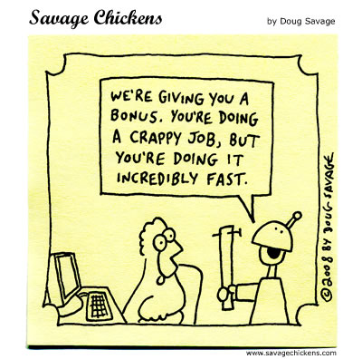
Things move fast. Technology advances. Efficiency is sought after. Sounds great to be able to automate things. Cookie-cutter our reports. The less you have to think about it the less you can screw up, right? And the more time we'll all have to have fun.
Ummm...no.
There's a widely recognized phenomenon going on in the sciences, which probably affects most other disciplines too. In the oil and gas industry it's sometimes called The Big Crew Change. Others just recognize it as a generational gap. The Baby Boomers, with all their experience and knowledge, are gearing up for retirement, ready to pass the torch on to the next generation. Houston, we have a problem. Only the problem is two-fold: not enough workforce to carry that responsibility and what workforce is there has half the experience.
For an ambitious young professional, this is the right time to be in the workplace, as there is tremendous opportunity to leap frog to higher positions, faster. Be warned, though. Those positions come with responsibility you need to be prepared to accept and should be trained to address. For science and engineering-based industries, we're heading into a challenging season and have been on that path for some time. The pursuit of science and engineering undoubtedly lead to advances in understanding and evolution of humankind. So how will that advancement progress (or even be maintained) with less human-power behind it? There are so many venues fed by the science and engineering disciplines.
Obviously, we should be concerned about the education offered to the up-and-coming professionals. Schools, starting even at the primary levels, should encourage and support education of the math, sciences, and critical thinking skills. I've witnessed a number of pushes in my local community to bring science and engineering to the young people early on, with career-day activities, extra-curricular programs, and field trips. The geoblogosphere also illustrate examples of this. Higher education needs to invest in hands-on, real-world learning. Things like field camp for geologists shouldn't be cut from the program. (See my earlier post for my thoughts on field camp). Companies, in turn, need to offer competitive incentives and a healthy, constructive work environment to retain and attract the skilled workforce. That's a challenge to companies, as it requires a real investment in the individuals if they want to be truly successful. The oil & gas industry particularly struggles with it's public image, not currently being helped with the ongoing Deep Water Horizon oil spill. John Hofmeister spoke at his keynote address at the 2009 OTC's young professional event (The Next Wave) of the need for companies to change their approach to mentoring and the "bloody" business practices that were the global norm for previous generations.
But it can't stop with the teachers and the businesses. Individuals should strive to learn from the experiences of those who've gone before and be well-versed in the basics. Ignorance won't be an acceptable excuse when things fail, tragedy strikes, and person/property are damaged. Failure is a teacher, but there's too much at stake most times to allow experience to come through failures. Our predecessors had failures, so why would we want to repeat them? The costs are too high.
At the same time, like novelist Kurt Vonnegut said, "True terror is to wake up one morning and discover that your high school class is running the country." I realized when I heard that the 80's classic movie Karate Kid was being redone that we're about there with my generation. Most annoying, the 2010 version focuses on kung-fu, not karate. Apparently details on the basics aren't any concern. Hollywood is full of this ignorance, as some geo-tweeters point out. (@morphosaurus: Looks like new Robin Hood movie was filmed in a conifer forest. Sherwood Forest is deciduous. As any fule kno.) Makes me wonder what other misconceptions are carried into the workplace (um, boobquake experiment anyone?) or what details someone thinks might not be important.
With all the specialties in every industry, it is easy to have the blinders slipped on and forget that our role affects (or is affected by) things around us. The widget-maker could easily get caught up in the mundane task of widget-making and not realize that the widget breaks (or is dangerous) when it's used, that no one is using the widget, or that changes in the widget are needed. The widget-maker might wonder why the widgets are piled up in the warehouse, a failure to communicate that widgets were even being made. The next generation of professionals will need to be open to cross-disciplinary understanding and be perceptive of what's going on beyond their own contribution. With less workforce available, we'll all have to pick up a little more load than what was traditionally expected. The widget-maker needs to be familiar with widget design, widget marketing, widget troubleshooting, widget de-commissioning and archival, and be open to learning these widget skills. The widget maker is still the expert at widget-making, but without an appreciation for these other aspects of the industry, their full potential at expertness is untapped. That's the challenge for our generation - to balance the generalist with the specialists.
Civil engineers face some of the most tangible examples of how ignorance can play out in their course o
 f work. A bridge collapse near Dublin, for example, was caused by poor understanding of earlier design & utility, combined with not recognizing the problem signs. The collapsed bridge and failed engineering illustrates the lack of appreciation/understanding of what our predecessors have started. M. King Hubbert said, "Our ignorance is not so vast as our failure to use what we know." The Baby Boomers know a lot. They need to share that knowledge, and the next generation needs to take it in, understand it, utilize it. (Photo courtesy of New Civil Engineer, http://www.nce.co.uk/news/transport/ignorance-over-structural-behaviour-identified-as-key-factor-in-irish-bridge-collapse/5215284.article).
At the end of the day, it comes down to basics. Understanding the basic principles of science, math, and physics. The scientific method. Basic geometry and algebra. Basic mater
 ial and mechanical properties. Don't be afraid to get up close and personal to the rock and learn what it can tell you. That's the stuff that forms the foundation onto which all other things are built. Basic soft skills, like communication and networking, are golden nuggets that will help the evolution of progress.
That old mantra K.I.S.S. (Keep It Simple, Stupid) still has application today. Just as the present is the key to the past is the key to the future. Knowing where to apply the details (and which key goes in which lock) is where the true art and skill come into play.
Saturday, November 21, 2009
Crazy Time of Year
Work schedules are demanding for me this time of year. The holidays are supposed to be a time to enjoy family and friends and the many blessings granted unto us. But I find it difficult to enjoy the time with deadlines looming, reports needing to be written, presentations that need to be prepared and presented. I break out in a cold sweat knowing that there's a stretch of a number of days longer than a weekend where progress won't be made on a project, and the deadline is hard set. I must be a total work-a-holic, because I can't seem to stop thinking about schedules and budgets and technical details that still need to be worked out and communicated.
I do have a great vacation coming up. The Rock Boat. Not a geological offshore field excursion, but rather an amazing floating music festival onboard a Carnival cruiseliner. Privately chartered by Sixthman, hosted by the band Sister Hazel, the cruise is a four-night non-stop musical journey. Port stop this year in Cozumel is just an added bonus. I need this vacation. I need to free myself from the all-consuming office politics and project particulars. I need to get in touch with the fun things in life and the joy that comes with listening to great live music. I need to stand in line at the buffet standing next to the guitarist of that awesome band. I need to chill on the couch at 3am listening to the impromptu jam session taking place with members of 4 different bands I saw performing earlier that day. I need the camaraderie of other totally obsessed music addicts. I'm sooo looking forward to January.
Hope you all get a chance to enjoy the upcoming holiday season. I wish you peace of mind in all your work/school efforts. Make sure you take time for yourself!
Wednesday, September 30, 2009
Social Networking for the Geologist
I am always interested in learning new technology, new software, and new ways to communicate with the tools available to us. In this time of instant communication - with mobile Facebook, Myspace, Twitter, and blogs - the ability to provide information, feedback, and share thoughts is astoundingly fast and easy. In my volunteer efforts with the Houston Geological Society, I constantly reflect on what can be done to improve communication within the organization and between the organization and it's very broad membership base.
A website dedicated to an organization obviously has to be the main heartbeat of that organization. Add on email newsletter blasts and you have an instant connection with your member. A Facebook page will connect you with the social networking savvy individuals, so that adds value, although it also adds on redundant effort and disconnect with the membership database that is centralized on the main website. A message board allows individuals to discuss topics of interest, post event information and updated news, and provide information for various opportunities. Private forums can even host behind-the-scenes planning for special committees or user-groups. In the end, these are all valuable contributions to the organization's web-presence. Nothing can replace the main website or the main membership database, but all can add to the group's visibility and distribution of information on the web.
Now enter Twitter. I'm super-curious what Twitter could do for the organization. Not just a particular committee like the NeoGeos, but the HGS as a whole. How many people would follow the largest local geological society? Would it contribute to an increase in membership? Would it increase attendance at the various lunch and dinner meetings? Or short courses? Would non-geology individuals gain something from following the tweets of the HGS? I'm tempted to set it up and try. But I wonder how many of the HGS members, or potential members, are out there twittering??
Tuesday, August 25, 2009
Driving Progress
It's pretty amazing to work on a project that is complex and frontier for its field. At the beginning, you don't realize what the heck you're getting into, then you're overwhelmed by how much you don't understand. At that point you seek understanding and are forced to deconstruct the problem into manageable pieces - plowing through the aspects you are comfortable with and tackling the ones you aren't. As the process continues, your understanding evolves, the pieces start to come together and then voila, the picture is clear and the project comes to completion.
Ha. I wish it were as easy a progression as that, although in a nutshell that pretty much describes what I've found to be true. Sometimes there are pieces that never fit. Those pieces might not fit because they are misunderstood, or they may not fit because the rest of the puzzle is screwed up somehow. Luck might be the only thing that allows you to differentiate; although you'd hope that a bit of education and networking could save you. Sometimes there are difficult lessons to learn along the way - perhaps related to technical aspects of the project, or perhaps related to soft skills - like communication and management. I'd hope that with every project there is a lesson learned...if not, I'd take that to be a sign it's time to move on to something else.
In the end, I think progress is driven by asking the right questions, recognizing what is understood and what is uncertain. Being able to throw stones at an idea to see how well it stands up to criticism and learning how to defend your ideas are essential skills if you are looking for success; skills that require professionalism, tact, and sometimes a pretty thick skin.
That's what I've witnessed so far, anyway. I wonder how the pieces of my project will come together?
Saturday, August 15, 2009
Why I Became a Geologist
There are certain experiences in my youth, looking back, that most definitely drove me towards the earth sciences. First, my father is an engineer - petroleum engineer, to be exact. I'm sure that his scientific and engineering tendencies influenced my own, although he rarely talked of his work at home. When I'd ask him about what he did, he'd always reply, "I'm a fortune teller." Chemistry sets and science projects were things he was constantly putting in front of me. I was interested, to a point, mostly out of curiosity. I never considered myself passionate about those things.


I did love to collect things. I'd collect rocks, but at that time it was more because of the look or feel of the rock not at all because of my understanding (or lack thereof) about its origin. I remember finding a large, smooth river rock that was strangely out of place amongst all the others and I held on to that rock for months. It would sit on the porch with me while I blew bubbles. Sometimes I felt like it talked to me (should I admit that?). It was a magic rock to me. I collected other things too. Insects, were my favorite. Butterflies, crickets, dragonflies, wasps, bees, spiders. I had a small little cigar box that I'd keep them in, with plans to one day formally identify each species and mount them. I had enough dragonflies and butterflies to see differences among them. I never quite got there with a mounted collection, but I sure had fun getting all my specimens together. My absolute favorite insects were the cicadas, who'd molt on the pine trees in my neighborhood. I was fascinated by these gentle, buggy-eyed, big-winged critters. Thus, began my fascination with nature. (Photo courtesy of Adam Fleishman, http://www.cicadamania.com/cicadas/2006/08/26/apache-cicada/).
My dad would take us on vacations, I realized later these were always scheduled around various annual industry conventions, where we'd go camping, hiking, and takes tours of historical sites. We spent a week in Yellowstone. I saw Old Faithful and held my breath through Geyser National Park. We spent two weeks driving through Mexico, from the northern Texas border all the way down to the Yucatan Peninsula and back. We climbed and explored every public pyramid around. We learned of the ancient civilizations and the cultures of Mexico. Experiences like these, while I didn't recognize the geologic or full historical significance, incited an interest in me and encouraged me to want to learn, explore, and enjoy what lay beyond my front yard.
In school I enjoyed most subjects. Social studies and history were my least favorite, but I did ok. English and science seemed to be my strengths. And although I'm not one of those math-in-my-head-on-the-fly types, I did alright in it. I joined student council, I played in the band, and participated in several other extra-curricular activities. The Ecology Club, my senior year, worked to establish one of the inter-building areas as an outdoor oasis of flowers and fountains (it was previously a neglected, weed-ridden eyesore that everyone walked by everyday). I was involved in recycling projects and other community educational programs through the various activities in school.
When it was time to choose a college and a major, I was kind of undecided. I leaned towards the sciences because I knew the job prospects would be good. I wanted to do something that was environmentally-focused, but didn't really know what that would translate into when it came to a job. I decided on Environmental Engineering. (I told you my dad's engineering qualities were an influence!) At the time, there weren't too many schools offering Environmental Engineering degrees, so I settled for Civil Engineering with the Environmental specialty. I applied to
the University of Texas at Austin (my dad's alma-mater), was accepted into the program and prepared for dorm life away from home. That's kind of when things took an unexpected twist.
My boyfriend of a year didn't want me to leave town, saying a long distance relationship just wasn't his thing. He was my thing, though, and I ultimately chose to skip the UT program and stay in Houston. I made my decision fairly last-minute and ended up with an application into our local community college. I took four semesters at San Jacinto Community College, knocking out all the basic english, history, economics, and a few electives. It was there that I truly discovered geology.
I was listed as a Pre-Engineering major on the San Jac records and I was scouring the list of available electives to add as transferable credits for a UH program. There sat geology...in black and white...staring up at me from the course listing. Physical Geology with Kristi Higginbotham was my first formal geology class. My initial thoughts, "oh yeah, we're going to learn about rocks" -- with a bit of sarcasm. Wow, was I ignorant! We went on field trips, we examined rock and mineral samples, we discussed the physical processes of the Earth. I found that it was easy for me and I enjoyed it. I never understood why some people in the class struggled with the rock and mineral identifications. The classroom samples were so textbook and the defining characterstics of cleavage planes, hardness, streak, and others made it fairly simple to identify. Of all the other classes I was taking and had taken, this class was the first that seemed truly effortless and exciting.
Ms. Higginbotham used the next semester to experiment with an Environmental Geology course. My class was her first to undergo the program and helped her to establish a lesson plan that she could use for future classes. The experience was fun and our tight-knit class did a lot of things together. We spent part of the class learning about the local EPA superfund site (the Brio Site) and got to know the full history of what occurred, the impact to the neighborhood and the politics that were involved with cleaning up the mess (that was back in 1996, or so). We also organized an extra-curricular group we called E.G.O. (Environmental Geology Organization). We did a lot of things that year that further encouraged us to be involved in our communities and to understand the importance of geology.
When it came time to transfer to the University of Houston, I had to decide what major to focus on. I could no longer skate through with Pre-Engineering tagged on to my file. UH didn't seem like the place for me to pursue Civil Engineering with an Environmental specialty. Geology was calling to me. I met with the counselor in the Geoscience Department (now called the Department of Earth & Atmospheric Sciences) and realized that I could easily get a double major in Geology and Geophysics, for the price of a few extra math classes. Well, sign me up!
The range of geology classes offered by the university was fantastic and their field program was great (and still is - check out my earlier blog regarding field camps!). The classes were small and the groups were close. I have many friends from my time spent at UH. One afternoon, while studying in the mineral lab, an upperclass student came in asking if anyone would be interested in a part-time job working for a geoscience consulting group. The job would involve binding reports, preparing graphics for figures/maps, and other intro level and admin-type tasks. Several of my friends took the job. I interviewed, but ultimately chose to work on campus, as it was closer to home for me. I eventually, though, ended up at that same company with my friends working a job that payed well above minimum wage and gave me exposure to seismic data, deepwater sedimentary environments, salt tectonics and what it was like to work with professionals in the major and large independent oil and gas companies.
I've grown tremendously since my starting days at that company. Some consider it strange that I've been there for what is now going on 10 years. I suppose that is rather unusual in these days of what seems like 2-year term limits for most everyone else. But I've climbed the ranks from the newbie student assistant up to Project Manager, and grown in my technical and soft skills every step of the way. I've had the priviledge to work on some of the coolest frontier exploration projects with some of the coolest people.
Looking back, some have asked if I regret not going to UT or pursuing the engineering career. I can honestly say, 15 years later married to my high-school sweetheart with three beautiful girls and a successful professional career....NO WAY!
I love what I do, I love my family, and I still think those smooth river rocks are pretty magical.
Subscribe to:
Posts (Atom)